7.6637° W
40.150027, −7.663713 · Silvares, Municipality of Fundão · Portugal

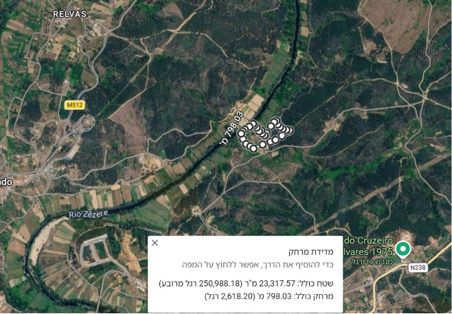
Useful landscape diversityRiver edge, open bench and wooded shelter can support a zoned permaculture design.
Corrected public approachSilvares and EN238 feed EM1062 toward Ourondo; the parcel lies on the Fundão side.
Three potential deal-breakersLegal access, parcel-level planning constraints and dry-season water rights remain unresolved.
Each category combines public evidence with an uncertainty penalty. River frontage, vegetation or parcel size cannot quietly become legal water, fertile soil or buildability.
Direct Zêzere frontage is valuable, but abstraction rights, summer flow, quality and flood constraints are not established.
Imagery suggests an open central bench and steeper wooded margins. The slope figures remain a modelled estimate.
Vegetation is encouraging, but no parcel-level soil class or laboratory profile is confirmed. Test depth, texture, pH and metals.
Fundão normals show useful annual rain but very dry July and August, plus hot days and winter frost.
Silvares was among the parishes affected by the 2025 fires; dense surrounding fuel makes access and defensible space essential.
Fundão PDM classification, REN/RAN, river margins and the legal status of every mapped structure still require written confirmation.
The public approach is EN238 to EM1062 toward Ourondo, then the local entrance. Legal access and all-weather condition remain unverified.
These findings widen the plot story without pretending regional data is parcel proof.
EM1062 is the municipal road between Silvares and Ourondo. The exact final entrance is visible in the supplied imagery, but its legal status and width need checking.
IPMA's Fundão normal records only 5.7 mm in July and 8.3 mm in August. A productive summer plan needs measured demand and storage.
The station averages 67.7 days at or above 30°C, 19.9 days at or above 35°C and 18 frost days. Design for shade, water and cold-air pockets.
Silvares appears in the municipality's list of parishes affected by the 2025 summer fires. This is regional evidence, not a parcel burn-history map.
LNEG documents acidic drainage and metals at historic tailings in the wider valley. It does not prove contamination here, but justifies baseline soil and irrigation-water tests.
Municipal records list town-level water, sanitation, power, telecom, transport and public services. None of that proves a connection at this rural parcel.
Public sources identify the Silvares-side approach. A title search and site visit must still establish the parcel's legal, year-round and emergency access.
A municipal notice temporarily closed a section of EM1062 in January 2026 after instability linked to severe weather. Treat this as a resilience warning, not evidence the road is currently closed.
No independent second exit is confirmed. Verify fire-engine width, turning radius, gate access, gradients and escape options before relying on the track.
Silvares has town-level water, sewer, power, telecom, transport and public services. Rural parcel connection points, capacity and extension cost are unknown.
Protect the riparian strip, place intensive production on the open bench and progressively break dense fuel into irrigated, accessible cells. Percentages are image interpretation, not cadastral land-use data.
The score is a triage tool. These checks decide whether this plot is genuinely viable for your intended use.
Ask for the exact PDM class plus REN, RAN, flood, watercourse, wildfire and road-servitude overlays. Confirm whether any structure has legal pre-existence and what use is possible.
Reconcile title, tax record and cadastral geometry. Confirm public-road frontage or a registered right-of-way, usable width, gradient, gate control, turning and a second fire-escape option.
Check legal abstraction, existing wells, August flow, water quality, historic flood marks and the storage required for the intended irrigated area.
Test the open bench, riparian edge and forest separately for depth, texture, pH, organic matter and nutrients. Add As, Fe, Mn, Cu and Zn as a regional legacy screen.
Price an all-weather approach, water points, fuel breaks, managed riparian vegetation and progressive conversion of dense fuel into a productive mosaic.
Open the public authority behind each signal. Source scale and confidence travel with the score; regional evidence is never labelled parcel proof.
TerraScore helps homestead and permaculture buyers find the answer before emotion—or a listing description—takes over.
Analyse another plot →